Private tour from San Juan or Dorado
Toa Baja Tour: History, Beach and the Best View of El Morro
Half an hour from the cruise ships there is a Puerto Rico most visitors never see. A 400 year old fort, a fishing village, a quiet local beach, sugar country and real neighborhoods where people wave back. I live here. Let me show you my town.
3.5 or 5.5 hoursTwo versions, door to door
From $275 per groupOne price per vehicle, not per person
Wednesday to SundayPlus holidays, hotel pickup included
Private, 1 to 14 guestsOnly your group in the vehicle
Mi gente, I am Capitán Jose Cruz. I am a boat captain, I run tours and transportation in Puerto Rico, and I live in Toa Baja. So yes, of course I built a tour in my own town.
Toa Baja sits right between San Juan and Dorado, and it looks like neither of them. San Juan is the walled city, the hotels and the traffic. Dorado is the resorts and the golf courses. In the middle is Toa Baja: flat green river land, an old Spanish fort sitting alone on the water, a village of fishermen and seafood kitchens, a beach where the families are local, and the suburbs where a big part of working Puerto Rico actually lives.
This Toa Baja tour is a private half day trip for travelers who want history, countryside and beach in one easy morning, away from the crowds. If you are looking for things to do in Toa Baja, or for a different day trip from San Juan, this is the one I would take my own family on.
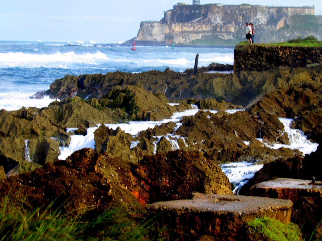
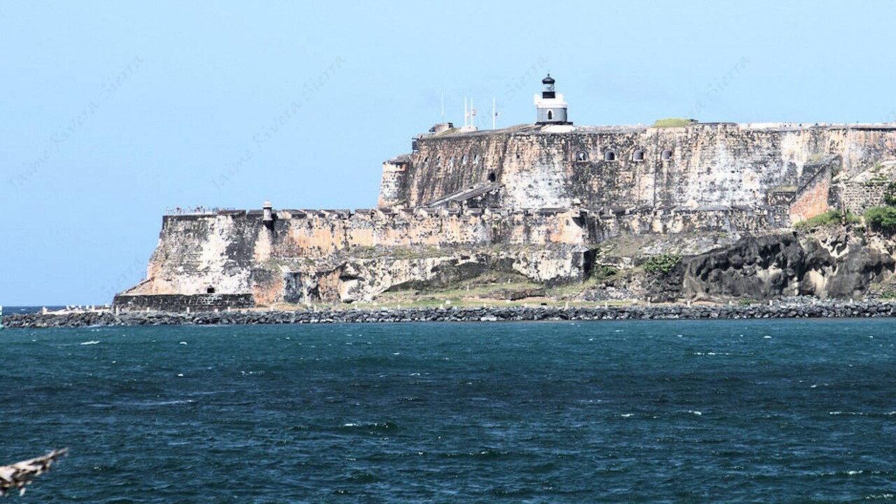
Ask anybody from here and they will tell you the same thing: the best view of El Morro is not in San Juan. It is from Toa Baja. From our side of the bay you see the whole fortress standing on its cliff, the lighthouse on top and the ocean breaking under it. Imponente. You cannot get that photo standing inside the fort.
What you will see on the Toa Baja tour
1. Isla de Cabras and El Cañuelo fort
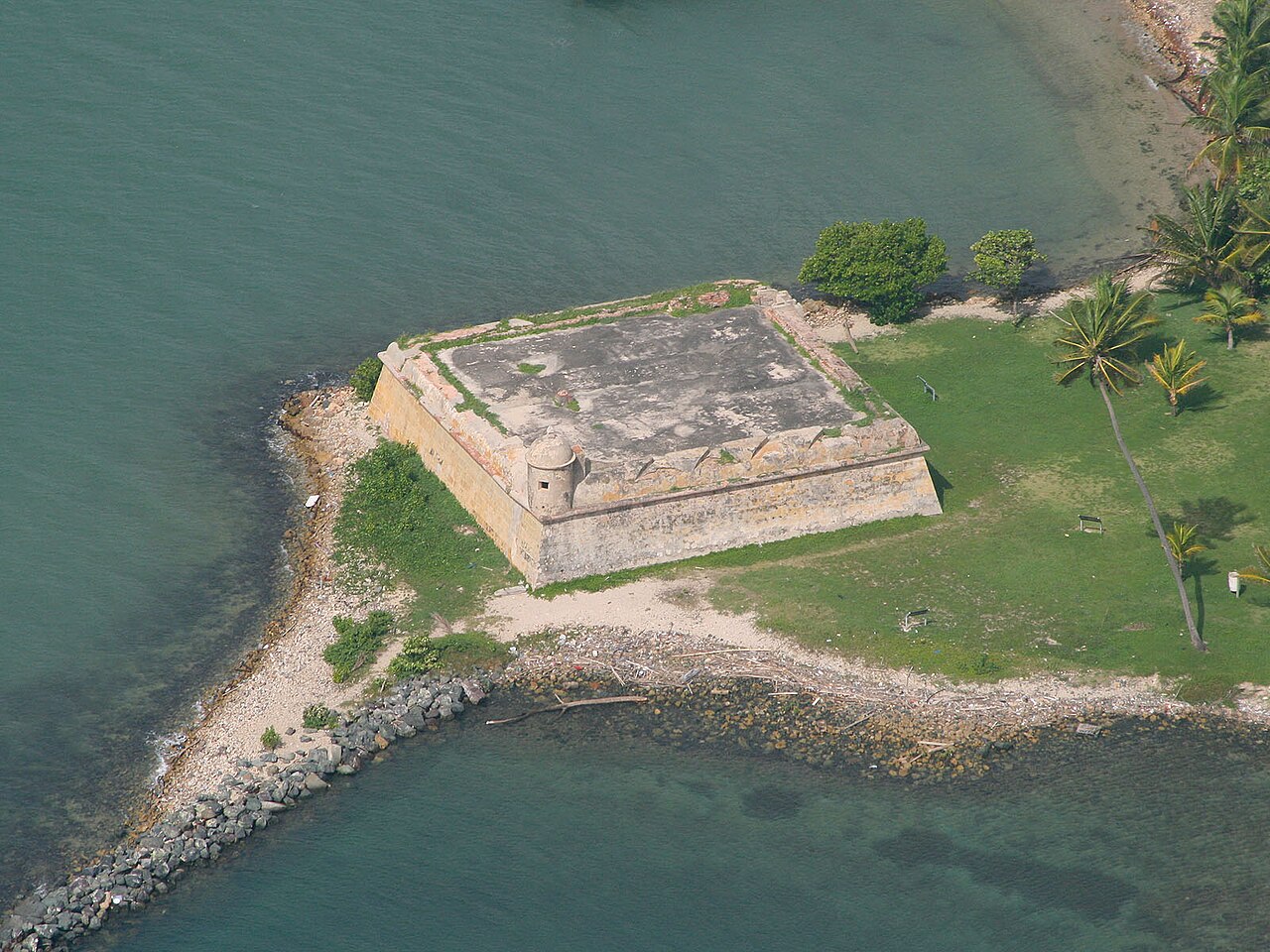
We start at the end of the road, on a small green peninsula at the mouth of San Juan Bay. Here stands the Fortín San Juan de la Cruz, which everybody calls El Cañuelo. It is the smallest fort of the San Juan defense system and part of the same UNESCO World Heritage site as El Morro.
Spain first fortified this spot in the 1590s, when Sir Francis Drake was attacking San Juan. The first fort went up between 1608 and 1610. In 1625 the Dutch took it, and it was burned in the fight to throw them out. The stone fort you see today was finished around 1660. Its job was simple: any ship trying to enter the bay had to pass between the cannons of El Morro on one side and El Cañuelo on the other. There is even an old story of a great chain stretched across the water between the two.
The fort was built on its own rock, surrounded by water, and soldiers reached it by boat. You cannot go inside today, but you walk all the way around the walls, and from here you get that view of El Morro I was telling you about.
2. The lazareto ruins and the big guns
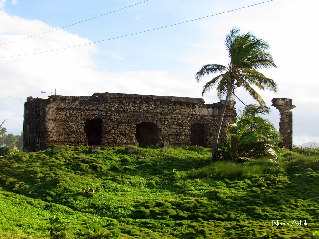
Isla de Cabras keeps a sadder chapter too. In the 1870s the Spanish government built a quarantine hospital here, a lazareto, for passengers and cargo arriving from ports with disease. Under the American government it became the island’s leprosy colony, and people lived out here, apart from everyone, until the colony moved to Trujillo Alto in 1926. Some of the brick walls are still standing.
Then came World War II. The United States Army built Fort Amézquita on this same ground, with Battery Reed and its two 12 inch guns pointed at the Atlantic. In 1943 the channel was filled in and the islet was joined to Palo Seco, which is why today we can drive right up to a fort that used to be an island.
3. Palo Seco, the fishing village
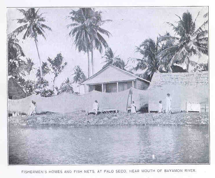
The only road out passes through Palo Seco, a narrow strip of land with the bay on one side and the ocean on the other. People have fished here for generations. Around 1900 a visiting fisheries researcher photographed the fishermen’s houses with their nets hung out to dry, and the feeling is still the same: boats, salt air, and one seafood kitchen after another. This is where a lot of sanjuaneros come on Sunday to eat fresh fish with a view of their own city.
All of this land has a story. In the early 1700s much of it, from the Bayamón river to the Toa, belonged to Miguel Enríquez, a shoemaker from San Juan, born to an enslaved mother, who became a privateer for the Spanish Crown and one of the most powerful men in the Caribbean. The King of Spain named him Capitán de Mar y Guerra. The chapel he built on his hacienda, the Ermita de la Candelaria, is one of the oldest church ruins still standing in Puerto Rico. As a captain myself, I love telling this one.
4. Levittown, where the good life begins
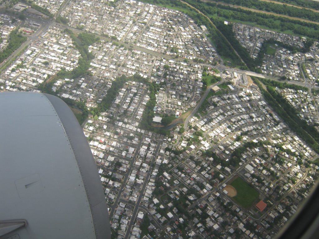
Now something no other tour shows you: the suburbs. In 1963 Levitt and Sons, the same builders who invented the American suburb in New York, opened Levittown de Puerto Rico on drained wetland here in Toa Baja. Governor Luis Muñoz Marín came to cut the ribbon. It was the first Levittown outside the mainland United States and the last one to carry the name. The plan was 3,000 homes. By the late 1970s there were more than 11,000, built around canals and a lake, sold with the slogan “where the good life begins.”
This is where the new Puerto Rican middle class moved in: families coming down from the mountains, veterans coming home, people returning from New York with children who spoke more English than Spanish. Singers Olga Tañón, Kany García and Jerry Rivera and world champion boxer Edwin “Chapo” Rosario all come from these streets. We drive the boulevard along the coast, pass the lake and the sky blue water tower that is now a public library, and you see how regular people live, shop, eat and say buenos días.
5. Punta Salinas beach
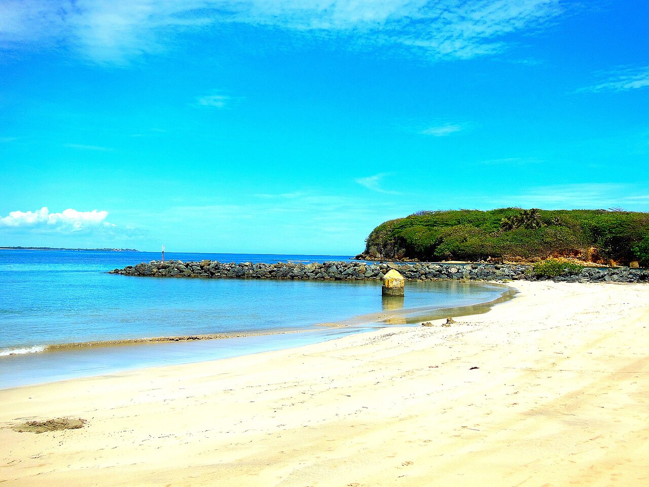
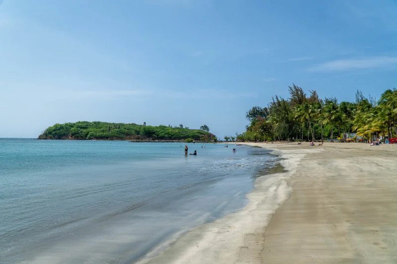
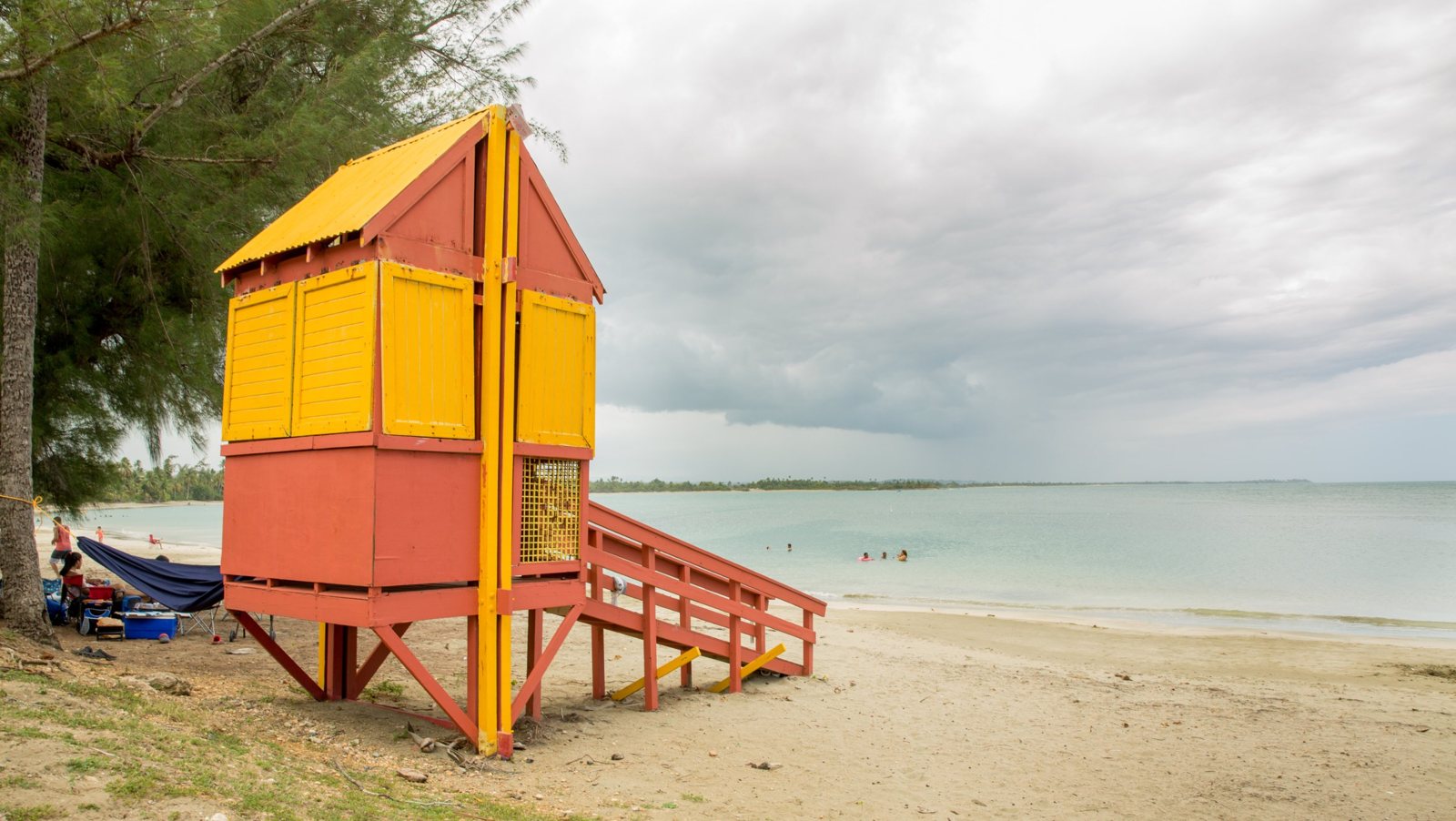
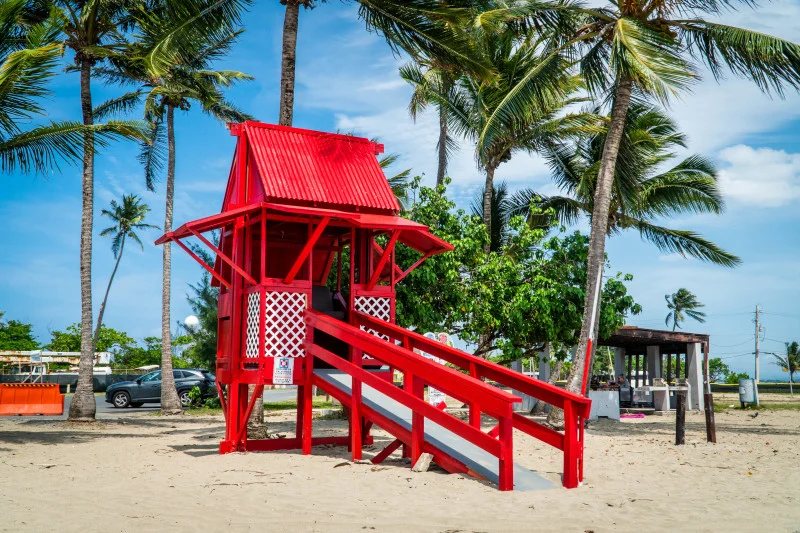
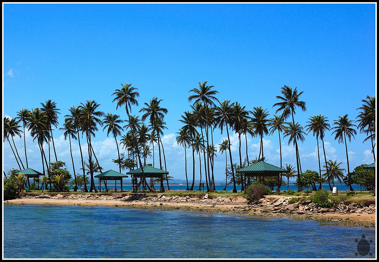
Time for sand. Punta Salinas is a public beach on a small point of land, with a wide crescent of calm, shallow water on the protected side, lifeguards, showers and shade. On a weekday morning you may share it with a few local families and nobody else. Sea turtles nest on this coast and manatees feed in these waters, so we look but we do not bother them. Bring your swimsuit. This is nothing like a hotel beach in Condado or a resort beach in Dorado, and that is exactly the point.
6. The old town, the plaza and the river
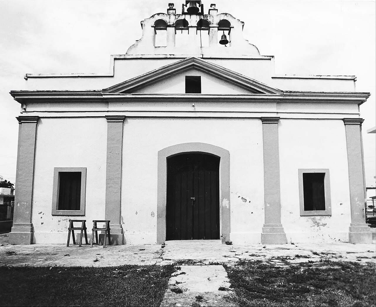
On the full tour we continue west through open green flatland to the pueblo, the original town. The plaza is named for Virgilio Dávila, the poet born here in 1869 who wrote about small town life in Puerto Rico better than anyone. Facing it is the parish church of San Pedro Apóstol, whose story goes back to the 1700s. The two keys on our flag and coat of arms are the keys of Saint Peter.
Just beyond runs the Río de la Plata, the longest river in Puerto Rico. The Taíno people called it Toa. It made this valley rich, and it is also why they call us la Ciudad Bajo Aguas, the city under water. More on that below.
7. Lunch where the locals eat
We finish at the table. You pick the place from my list further down, seafood by the water in Palo Seco or comida criolla in Levittown, and you pay your own bill at local prices, not hotel prices.
A short history of Toa Baja, the town that fed San Juan
I want you to arrive knowing where you are standing, so here is the story the way we tell it at home.
Before the Spanish. This valley was Taíno land, the region of Toa. The name comes from the river, and many people here will tell you Toa means mother. “Baja” is for the low, flat land near the coast. Our little sister, Toa Alta, sits higher up the same river.
The first farm. Around 1511, only a few years after the Spanish arrived, the Crown set up an experimental farm in this valley, where settlers learned from the Taíno how to grow the crops of the island and tested crops brought from Spain. Sugarcane, rice and ginger did well. Wheat did not. That makes Toa Baja one of the first places in Puerto Rico that Europeans farmed.
Canary Island families. The rich river soil and the fishing drew settlers, many of them from the Canary Islands. The surnames Marrero, Salgado and Martínez, which you will still see everywhere here, go back to those first families. The town was formally organized in 1745 and its parish followed in 1749.
The pantry of the capital. By 1776 this area counted 12 sugar estates and 6 cattle ranches. Oranges, lemons, guavas, rice, corn, molasses and rum went from here to San Juan by road and by river. As the capital grew, Toa Baja fed it.
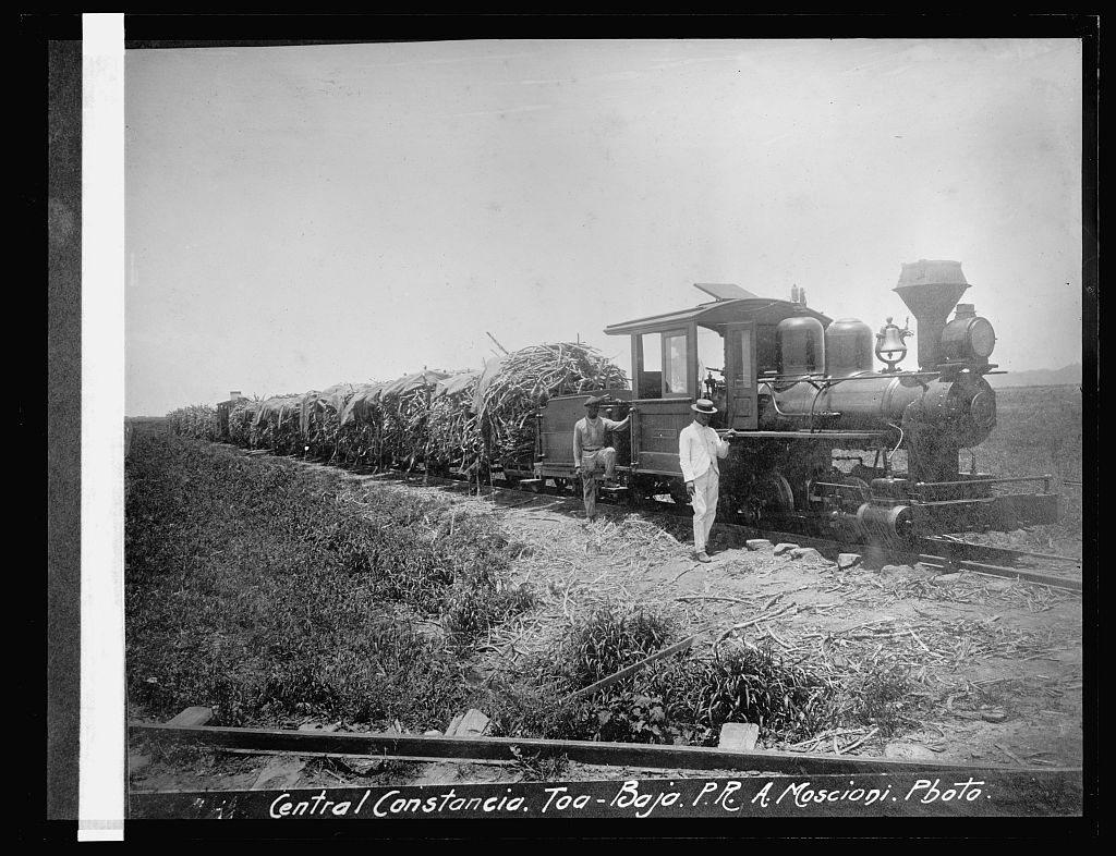
Sugar and those who cut it. Hacienda Santa Elena was founded in 1790 and became one of the most productive estates on the north coast, with its own dock on the river and, by the 1830s, a steam powered mill. That wealth was built on the work of enslaved people. In 1843 enslaved workers in Toa Baja rose up and marched on the town before the Spanish militia put the rebellion down. It is part of our history and we tell it.
The river gives and the river takes. The same Río de la Plata that made the soil rich has flooded the town again and again. In 1841, tired of the water, a group of neighbors asked to move to higher ground. The next year that settlement became its own town. You know it as Dorado. So the next time someone tells you about fancy Dorado, you can tell them it started as a piece of Toa Baja.
The twentieth century. Times got so hard that in 1902 Toa Baja was annexed to Bayamón. We got our town back in 1905. Central Constancia kept grinding cane, with its own little railroad, until it closed in 1962. One year later Levittown opened, and a town of about 20,000 people grew past 78,000 by 1980. Cane fields became neighborhoods almost overnight.
Today. About 75,000 of us live here. Hurricane María in 2017 pushed the river over its banks one more time, and we rebuilt one more time. We call ourselves llaneros, people of the plains, and we are proud ones.
The people you will meet
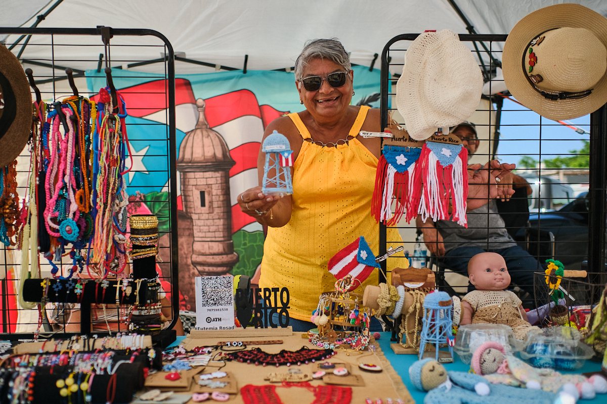
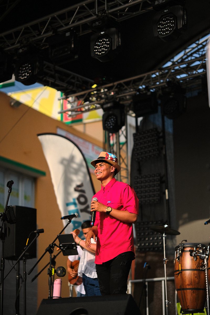
The best part of Toa Baja is not a building. It is the people. Here nobody is performing for tourists. The lady selling crochet at the artisan market made every piece herself, including little versions of our water tower, and she will tell you about each one. The kid singing at the fiestas is somebody’s nephew and half the plaza knows his name.
We are a town of festivals: the artisan fair in March, the Fiestas Patronales de San Pedro Apóstol in June, the beach festival in July and the Festival de la Zafra in October, with bomba and plena to remember the sugar harvest. If your date lines up with one, I will make sure we stop. If it does not, you will still shake hands with the fisherman, the cook and the neighbor, and that is what you will remember when you get home.
The schedule: two ways to do it
Both versions are private and start at your door. Times are for a 9:00 a.m. pickup in San Juan; we can start earlier or later.
Toa Baja Express, about 3.5 hours
- Pickup at your hotel, rental or the cruise pier
- Isla de Cabras: El Cañuelo, the lazareto ruins, the El Morro view (1 hour)
- Palo Seco: the fishing village and a stop for frituras
- Punta Salinas beach (45 minutes)
- Back at your door
Best for cruise passengers and anyone with an afternoon flight.
Full Toa Baja, about 5.5 hours
- Pickup at your hotel, rental or the cruise pier
- Isla de Cabras: El Cañuelo, the lazareto ruins, the El Morro view (1 hour)
- Palo Seco fishing village
- Levittown: the boulevard, the lake and the water tower
- Punta Salinas beach (45 minutes)
- Old town: plaza, church and the Río de la Plata
- Lunch at the restaurant you choose (1 hour)
- Back at your door
The whole story, with time to eat and swim.
Prices
The price is for the whole vehicle, so the more of you there are, the less each person pays.
| Tour | SUV, up to 4 guests | Van, up to 6 guests | Van, up to 14 guests |
|---|---|---|---|
| Toa Baja Express, about 3.5 hours | $275 | $360 | $480 (about $34 each for 14) |
| Full Toa Baja, about 5.5 hours (most complete) | $375 | $480 | $640 (about $46 each for 14) |
Included
- Private vehicle with air conditioning and a local driver guide
- Pickup and return in San Juan, Condado, Isla Verde, Old San Juan, the cruise piers or Dorado
- Parking and park entry for the vehicle
- Cold bottled water
- All the stories, sin costo adicional
Not included
- Lunch, snacks and drinks (you choose where and what)
- Tips for your driver guide
- Beach towels: bring your own, plus a swimsuit, sunscreen and a hat
I will be straight with you, as always: we are not the cheapest ride on the island. You are paying for a private vehicle, a driver who knows these streets, and a route that somebody who lives here put together.
Your guagua, your pace
Here we call the van la guagua. On this tour it is all yours. Nobody else gets on, there is no microphone and no flag to follow. You want ten more minutes on the beach, another photo of El Morro, or a stop at the bakery you just saw? Dígalo. That is the difference between a private tour and a bus tour.
Families with kids, grandparents and groups of friends all fit this tour well. There is very little walking, it is flat everywhere, and every stop has shade.



These are our own vans: black, high roof, cold air conditioning and room for up to 14, with a driver who opens the door for you. Our guests tend to get out smiling.
Where we eat: you choose from the local favorites
Toa Baja has more good places to eat than I can count, so I narrowed it down. Tell me what you are in the mood for and I will call ahead. Before your date we confirm that the place you picked is open that day.
| Restaurant | Where | What it is known for |
|---|---|---|
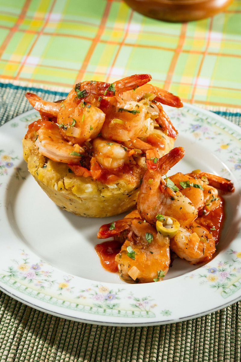
| Restaurante Los Serranos | Palo Seco | Family seafood kitchen: fried red snapper, mofongo with shrimp, coffee flan. Opens Thursday to Sunday. |
| La Garita Waterfront | Palo Seco | Deck over the water with the view of Old San Juan, mofongo and seafood. |
| El Marlin Verde | Palo Seco | Small mariscos spot: octopus, shrimp in criollo sauce, whole fish. |
| El Kampestre | Levittown boulevard | Churrasco, chuleta kan kan and mofongo, a neighborhood favorite for years. |
| Restaurante Costa Criolla | Levittown | Family owned criollo cooking, bacalaítos and fried cheese to start. Closed Sunday. |
| Punto Criollo | Levittown | Lunch specials: chicharrones, tostones, rice and beans. |
| La Cabaña | Levittown | Seafood bar and grill that handles big groups. Closed Monday. |
| Martin’s BBQ | Levittown | Pollo asado with rice and beans. Fast, cheap and very local. |
| Flor de Mayo | Levittown | Chinese food the Puerto Rican way, with fried rice and tostones on the same plate. Every boricua suburb has one, and this is ours. |
| Kiosco El Buen Sabor | Roadside chinchorro | Frituras and seafood cups to eat standing up, the way we do it. |
Is this the right tour for you?
You have already seen Old San Juan. Perfect. Now see it from the other side of the bay and hear the half of the story the walking tours leave out. You are staying in Dorado. We are next door, and we pick you up there. You are on a cruise for one day. Take the Express and you are back at the pier with time to spare. You want a full beach day. Then this is not it; ask me about the boat instead. You want rainforest. That is El Yunque, on the other side of San Juan.
Good to know
- Isla de Cabras and Punta Salinas are municipal parks that open Wednesday to Sunday and on holidays, so the tour runs on those days.
- You cannot enter El Cañuelo. We visit it from outside and walk around its walls.
- The water at Isla de Cabras has currents and rocks. We swim at Punta Salinas, not there.
- Hacienda Santa Elena and the Ermita de la Candelaria are on private or protected land and were badly damaged by Hurricane María. They are part of the story we tell, not stops where we get out.
- Rain in Puerto Rico usually passes in minutes. If the weather is truly bad we move your date at no charge.
Quick answers about Toa Baja
Where is Toa Baja?
On the north coast of Puerto Rico, directly west of San Juan Bay, between San Juan and Dorado. Isla de Cabras is about 30 minutes by road from Old San Juan or Condado, and about the same from Dorado.
What is Toa Baja known for?
El Cañuelo fort and Isla de Cabras, Punta Salinas beach, the seafood restaurants of Palo Seco, Levittown, its sugar history, and the Río de la Plata that floods it.
Where is the best view of El Morro?
From Isla de Cabras and Palo Seco in Toa Baja, straight across the entrance to San Juan Bay. It is the only place on land where you see the whole fortress from the water side.
Can you swim at Punta Salinas?
Yes. The protected side of the point has calm, shallow water and lifeguards on duty during park hours.
Is Toa Baja worth visiting?
If you want to see how Puerto Ricans really live, with history and a beach on the same morning and almost no other tourists, yes. I am biased, but I am also right.
Can I visit Toa Baja on my own?
Of course. With a rental car it is an easy drive on PR 165, and parking at the two parks costs a few dollars at most. What you get with us is the stories, the right order, the restaurant picks and nobody having to drive after lunch.
Only need a ride to Isla de Cabras, Punta Salinas or a restaurant in Palo Seco? We also offer private transportation by the hour to anywhere in Toa Baja, and your driver waits to bring you back. If you need it, get in touch and we will gladly set it up, con mucho gusto. See our private driver service.
Keep exploring: Old San Juan tours, things to do in San Juan, boat tours compared, cultural experiences and all destinations.
Your host, a real person
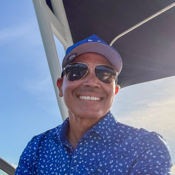
Capitán Jose Cruz
Boat captain, tour and transportation operator, and proud resident of Toa Baja. I designed this route myself, in my own town. This is our own tour, run by ThingsToDoPR and Luxplora, our transportation company. ¡Nos vemos en Toa Baja!
Come see my town
Send me your date, how many you are and where you are staying. I will confirm availability and the total price in writing before you pay anything.
Book on WhatsApp
Call 787-949-3542
Prefer a form? Contact us.